City Walk
Monalisa (Lisa) Malani (2023)
City sidewalks significantly impact the social and environmental aspects of urban life. Unfortunately, due to the high cost and time-consuming nature of data collection and evaluation, cities lack records of their sidewalks at street level and census-tract granularity. In fact, only 34% of cities offer data on sidewalks and even fewer on other forms of pedestrian and accessibility infrastructure such as crosswalks, curb ramps, and sidewalk gaps. This lack of data hinders research on city sidewalks, limiting our understanding of their current conditions and spatial distribution.mmalani-mssd_architecture-2023.
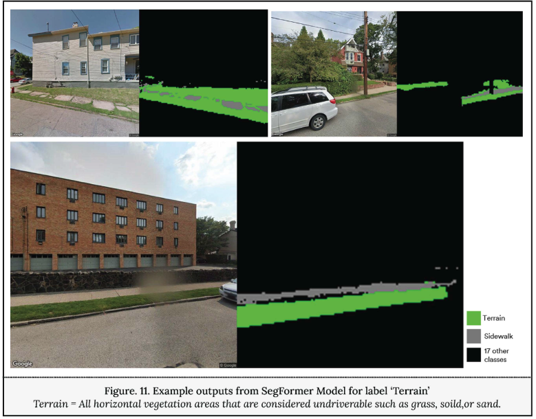
To address this issue, recent research aims to demonstrate the viability of an automated methodology that integrates deep learning, computer vision, and geospatial processes. This methodology utilizes openly available street-level images to classify sidewalk surface data, such as material, accessibility, and quality. The objective is to employ deep learning models to classify pavement materials and detect the presence of open green covers around sidewalks. The study also developed a multi-label classification model to classify accessibility parameters. This model was trained on a set of manually labeled data from Pittsburgh, Seattle, Oradell, and Newberg. Various metrics, including mean IoU, F1 score, accuracy, precision, and recall, were used to evaluate the model’s predictive accuracy.
The research offers several results, including generating a scalable and generalizable workflow to automate data extraction from street-level imagery, conducting a preliminary correlation study between sidewalk surface data, environmental factors, and human health and safety factors, and developing an interactive mapping tool with an open dataset. This mapping tool can aid researchers, governments, and the public in finding better policies and strategies contributing to the sustainable development of cities.
By providing explicit and extendable methods to gather city surface data, this research provides urban analysts and city planners with the necessary information to address urban sustainable development concerns and promote data-informed planning and design development.